Modern warning systems are not a single alarm, but a chain linking hazard detection to public action. So, which technologies are used in modern warning systems? The answer spans weather radar, satellite imagery, river gauges, seismic sensors, connected monitoring networks, forecasting models, and artificial intelligence. At the public end, alerts may arrive through sirens, radio, television, mobile broadcasts, and emergency apps. Each tool has a different job. A radar image can track a storm; a clear phone alert can help someone decide when to move.
The World Meteorological Organization’s 2023 Global Status of Multi-Hazard Early Warning Systems report found that countries with limited early-warning coverage had nearly six times the disaster-related mortality of countries with substantial to comprehensive coverage. That figure supports investment, but it does not prove that technology alone saves lives. UN Secretary-General António Guterres has put the principle simply: “Early warning systems save lives.” WMO’s Early Warnings for All initiative also highlights the need to connect risk knowledge, observation and forecasting, communication, and preparedness.
This “China Top 10 Modern Warning System Technologies” overview examines how these components work together, from remote sensing and AI-assisted forecasting to location-based alerts and control-room platforms. It also considers practical limits: sensors can fail, network access can be uneven, and an alert can arrive without being understood. A polished dashboard is not the same as a prepared community. That distinction is easy to overlook. These technologies matter most when accurate warnings reach people in time, in language they understand, with clear steps to take.
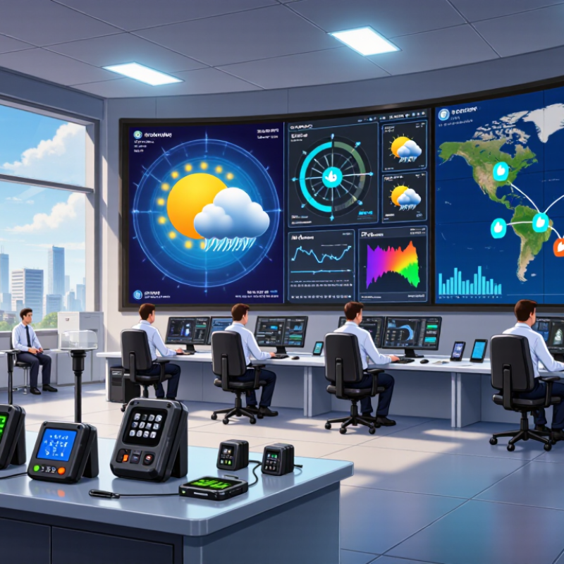
A modern warning system is more than a siren or flashing light. It is a chain that detects a hazard, checks relevant information, and delivers a clear alert to people who may be affected. Inputs can include sensors for smoke, water levels, structural movement, or weather. The system’s value depends on how reliably those inputs are interpreted. A sensor can be precise and still miss a changing situation.
A useful warning should state what is happening, where it matters, and what action people can take. Messages may reach phones, public displays, speakers, or control rooms, since one channel can fail. Clarity matters. A short instruction, such as moving away from a low-lying road, is easier to act on than a technical reading alone. Systems also need testing, backup power, and regular checks of sensors and communication links. That work is easy to overlook. False alarms can weaken trust, while delayed alerts can leave little time to respond. No design removes every uncertainty, so operators need ways to review unusual readings and correct messages quickly. A warning system is only dependable when people can understand and use its alerts.
China’s warning systems combine national monitoring with local response tools, and coverage varies by hazard and region. Doppler weather radar tracks storm movement and rainfall, while meteorological satellites observe cloud development over wide areas. Automated rain gauges provide ground-level measurements. River-level sensors help officials spot rising water near reservoirs and communities. Seismic stations detect ground motion and support earthquake alerts. Short lead times matter.
For landslide risks, inclinometers and positioning sensors can reveal gradual slope movement, though readings need local interpretation. Air-quality monitors measure pollutants near roads and industrial areas. Satellite imagery can flag heat patterns linked to wildfires, but clouds may obscure details. Emergency broadcasts carry instructions, while mobile alerts can reach people quickly. Outdoor sirens remain useful when phones are silent or networks fail. Keep it simple.
These technologies work best when readings are checked against field reports and shared in plain language. Thresholds can trigger false alarms, and uneven signal coverage may leave gaps. That is not a small issue. Public guidance should explain what is known, what remains uncertain, and where people should go. Maintenance and regular drills also matter.
Indicative warning horizons for major hazard-monitoring technologies used in China. Actual lead times vary with hazard location, forecast confidence, sensor coverage, and local conditions; these values are illustrative, not official performance statistics.
Earthquake early warning may provide only seconds of notice, while weather and hydrological forecasts can offer hours or days. The logarithmic scale makes these very different time horizons easier to compare.
Modern warning systems combine different sensors to detect changes that may signal danger. Ground radar tracks movement through rain or darkness, while thermal cameras register unusual heat. Acoustic sensors can identify sharp sounds, and seismic monitors detect vibration beneath roads or buildings. Weather stations measure wind, rainfall, and pressure; air-quality sensors watch for sudden changes in particles or gases. Satellite imagery can show flooding, fires, or damaged infrastructure across wide areas. No single sensor tells the whole story. Signals matter.
Networks connect these readings and send alerts to people who can assess them. Some systems filter data near the sensor, reducing delays when a central connection is weak. Others compare readings from several locations before raising an alarm. A rising river gauge, for example, becomes more useful when nearby rainfall and upstream measurements support the same warning. Context matters. Sensors can fail, drift out of calibration, or mistake ordinary activity for a threat. Even a well-designed network may have blind spots, especially during power cuts or severe weather. These limits deserve regular testing, clear alert rules, and human review. Not perfectly. A warning system is only as dependable as its maintenance and the decisions made after an alert arrives.
| Technology | What It Detects | Sensors and Networks | Typical Warning Use | Important Limitation |
|---|---|---|---|---|
| Weather radar and nowcasting | Rainfall intensity, storm movement, and signatures associated with severe thunderstorms or hail | Weather radar, satellite observations, rain gauges, and numerical forecasting networks | Short-term alerts for heavy rain, thunderstorms, strong winds, and some hail events | Radar coverage and terrain can affect observations; very local events may develop quickly. |
| Earthquake early warning | Initial seismic waves from an earthquake, before stronger shaking reaches more distant locations | Seismometers, rapid signal processing, communications links, and public alert channels | Provides nearby areas with seconds of notice in some cases, supporting protective actions and automated responses. | It cannot predict earthquakes in advance; locations close to the source may receive little or no lead time. |
| Flood and river-level monitoring | Rising water levels, flow rates, rainfall accumulation, and potential exceedance of warning thresholds | Water-level gauges, flow meters, rain gauges, weather forecasts, and telemetry networks | Flood advisories, reservoir and river monitoring, and time-sensitive evacuation planning | Forecast reliability depends on sensor coverage, watershed conditions, and the speed of rainfall and runoff. |
| Landslide and slope-deformation monitoring | Ground movement, slope displacement, cracking, and changes that may indicate instability | GNSS stations, inclinometers, tiltmeters, rain gauges, ground-based radar, and satellite InSAR | Risk monitoring for unstable slopes, transport corridors, and settlements in mountainous areas | Slow movement does not always lead to failure, and sudden landslides can occur between observations. |
| Satellite wildfire detection | Thermal hotspots, smoke signatures, and changes in vegetation or burn area | Thermal and optical satellite imagery, aerial observations, lookout reports, and field sensors | Identifies possible fire locations and supports fire monitoring across large or remote areas. | Cloud cover, revisit intervals, smoke, and small or short-lived fires can delay or obscure detection. |
| Air-quality sensor networks | Particulate matter and selected gases, including pollutants used in public-health advisories | Fixed monitoring stations, calibrated analyzers, meteorological sensors, and data platforms | Tracks pollution episodes and provides information for health guidance and pollution-response measures. | Low-cost sensors may require calibration; readings vary with location and meteorological conditions. |
| Structural health monitoring | Vibration, strain, tilt, displacement, and other indicators of structural change | Accelerometers, strain gauges, displacement sensors, fiber-optic instruments, and wired or wireless data links | Supports condition assessment of bridges, tunnels, dams, and other critical infrastructure. | Sensor readings need engineering interpretation; monitoring alone does not establish structural safety. |
| Maritime radar and vessel tracking | Vessel position and movement, navigational hazards, and selected surface or coastal conditions | Coastal radar, vessel identification broadcasts, satellite observations, and maritime communications | Supports navigation safety, vessel traffic awareness, and warnings related to hazardous sea conditions. | Tracking broadcasts may be unavailable or incomplete; radar performance depends on range and weather. |
| Urban emergency sensing and alert networks | Localized hazards such as abnormal water accumulation, smoke, gas leaks, or equipment alarms | Distributed environmental sensors, building systems, municipal communications, and emergency-operation platforms | Routes alerts to operators or the public and helps coordinate responses across urban services. | Reliable operation depends on power, communications, maintenance, and procedures for validating alerts. |
| Multi-source risk analysis and alert dissemination | Potential threats inferred by combining observations, forecasts, thresholds, and incident reports | Data platforms, geographic information systems, forecasting models, cellular networks, broadcasting, and local warning channels | Combines hazard information and distributes warnings through appropriate public or operational channels. | The quality of an alert depends on input data, clear thresholds, network availability, and timely human decisions. |
Note: These are technology categories used in modern hazard monitoring and warning systems; deployment, coverage, and alert lead time vary by location and hazard.
A warning is only useful when its data is checked and its message reaches people in time. Modern systems compare readings from weather stations, radar, satellites, river gauges, and local observers. Automated checks flag missing values, sudden jumps, or sensor faults. Analysts then compare independent sources and review the affected area before issuing an alert. This can take time. It can also prevent a faulty reading from triggering needless alarm.
The World Meteorological Organization’s 2022 Global Status of Multi-Hazard Early Warning Systems report notes that 24 hours’ notice can reduce disaster damage by 30%. Verification must therefore be fast, but not careless. Alerts need a clear location, hazard, expected timing, and practical action. They can travel through cell broadcast, radio, sirens, and public alert applications. Using several channels matters: power, networks, or phone access may fail. The report also found that disaster mortality was nearly six times higher in countries with limited early-warning coverage than in those with substantial or comprehensive coverage. Coverage is not just technology; people must understand and trust the message.
Tips: Check the timestamp and location before forwarding an alert. Keep a battery radio available. Small gaps remain—especially for remote communities and people who need accessible formats.
Modern warning systems in China cover weather hazards, floods, earthquakes, fires, transport disruptions, and industrial incidents. Each system must turn sensor readings into clear, timely action. A rainfall alert, for example, is more useful when it names the affected area, expected timing, and practical safety steps. Performance depends on warning lead time, delivery speed, geographic coverage, and the number of missed or false alerts.
Challenges remain. Sensors may fail during severe weather, while network congestion can delay messages just when people need them most. Alerts also need plain language, accessible formats, and local detail. A technically accurate message can still confuse residents if it lacks clear instructions. Warning systems should be tested regularly, with results shared transparently. I would not treat any single performance figure as proof of reliability; field conditions vary, and systems can have gaps.
Tips: Keep phone alerts enabled, check local emergency guidance, and know two safe places near home or work. If an alert seems unclear, verify it through official local channels. Don’t ignore repeated drills.
Ground radar tracks movement in darkness or rain. Thermal cameras detect unusual heat. Other sensors monitor sound, ground vibration, weather, air quality, and satellite images. No single sensor sees everything.
Multiple readings can help confirm a developing hazard. A rising river gauge means more when nearby rainfall and upstream levels also rise. Context matters.
Automated checks flag missing data, sudden jumps, or possible sensor faults. Analysts can compare independent sources and review the affected area. This takes time, but can prevent false alarms.
Messages may arrive through phone broadcasts, radio, sirens, or public alert applications. Several channels help when power, phone access, or networks fail. Keep a battery radio available.
It should identify the location, hazard, expected timing, and practical action. Plain language matters. A technically correct message can still confuse people.
Reliability depends on maintenance, coverage, delivery speed, and human decisions. Sensors can drift, networks can slow, and severe weather can cause blind spots. I would not trust one reading alone.
A cited global report says 24 hours’ notice can reduce disaster damage by 30%. Seconds matter too, though field conditions vary.
Keep phone alerts enabled and check local emergency guidance. Know two safe places near home or work. If an alert is unclear, verify it through official local channels. Small gaps remain.
Modern warning systems combine monitoring, data analysis, and communication to identify hazards early and give people time to respond. This overview considers which technologies are used in modern warning systems, including weather radar, satellites, seismic sensors, river and rainfall gauges, geological monitoring devices, wildfire detection, air-quality sensors, public-health surveillance, and connected communication networks. Together, these tools track changing conditions across cities, rural areas, and critical infrastructure.
Sensors send observations to analysis platforms, where information from multiple sources can be checked for consistency and assessed against warning thresholds. When a credible risk is identified, alerts can be shared through mobile messages, broadcasts, online channels, and local public-address systems. These systems support responses to storms, floods, earthquakes, fires, and other emergencies, but their effectiveness depends on reliable equipment, clear messages, timely delivery, and public preparedness. Data quality, network coverage, false alarms, and coordination remain important challenges.

Agonex Safety